Maps and Water

We carried a combination of the Hayduke Trail Guidebook by Joe Mitchell and Mike Coronella and the Hayduke Trail Hiking Resources Bundle by Andrew Skurka.  Both were helpful in planning our caches and resupplies, as well as on trail for route finding and navigation. Most often we referred to the maps in the Bundle and occasionally cross referenced the Guidebook for more detailed info. on landmarks and terrain to help us navigate.

We mainly used maps and compass, but carried a DeLorme inReach which we called our "back up" and used it occasionally to confirm our location with GPS coordinates. The inReach was helpful on many occasions to confirm or deny that we were located where we thought we were on the maps. We also used the inReach to text family when we needed an unexpected package mailed. It was also carried as our emergency beacon device. I am sure it has many great features other than the three basic functions that we utilized, however we still have yet to learn about or use all of the functions that it offers. For the purposes that we wanted, it worked great.

The Hayduke Trail Hiking Resources Bundle provided detailed information on water  sources with an included water chart which has information compiled from several hikers over the course of several years. Next to the maps, we found this information to be the most useful during our journey. However, the water notes provided by hikers were mainly from those who had traveled during the spring season  over five years ago. This had us a little concerned about how applicable this would be to our journey. We found much of the information to be useful, but we also made notes on each of the water sources that we encountered so that we could provide updated information from the fall season. We wanted to provide this information to any future Hayduke hikers so I have compiled these updated Hayduke water notes to share.

The Hayduke Trail was an incredible adventure. The tools and information that we had access to prior to our journey were very helpful in allowing us to travel with ease and enjoyment. We also know that the desert should be regarded with much respect and appreciation as it is a challenging environment, but one that can leave a deep impression in your being.


Hayduke Trail Water Updates~ Fall 2014

Below are updates/additions to the water chart of The Hayduke Trail Hiking Resource Bundle by Andrew Skurka. Water sources are named and in same order as found on the water chart. These water notes are provided to give updated water info. and provide more details as to water availability in the Fall season. Please keep in mind that ALL water sources are subject to change drastically each season and year. In addition to using the below water sources we cached water in certain locations to ensure we would have access to water throughout long dry stretches. Please plan and play carefully when adventuring in the desert!

*If we did not go to a particular water source I have marked with a ?


Section One~ Late September 2014

  • Willow Spring~ small pools
  • Courthouse Wash~ lots of water
  • Matrimony Spring~ ?  did not see/stop but heard from locals in town the flow was great
  • Moab~ Moab Cyclery offered a covered area w/tables to organize our gear, water and showers. Gearheads Outdoor store held our resupply boxes for us. Great gear, wonderful filtered water for free
  • *there is access to CO river leaving Moab mile 27.3 to mile 30. Silty water, but accessible
  • Kane Spring~ Great flow, great water
  • Kane Creek~ Good Flow, very silty

Section Two~ Late September 2014

  • Colorado River (mile 44 and 44.7)~ Did not access, but river obviously flowing 
  • Unnamed Spring~ very, very small seep
  • Piped Dripping Spring on North Wall of recessed side canyon~  Good trickle, piped to trough. Able to fill directly from trickle, trough was overflowing
  • CO River~ Did not access
  • Unnamed Spring~ Flowing Water in wash below spring alongside trail
  • Indian Creek~ Lots of water, great flow but silty
  • Spring in Little Spring Canyon~ ?
  • Canyonlands Visitor Center~ Water Fountain 
  • Needles Outpost~ Water available if you stay or purchase from store. NOT FREE; WILL NOT HOLD BOXES. (Very unpleasant experience for all hikers we met who visited here. Store very low on supplies. Suggest skipping this stop)

Section Three~Late September 2014

*recent storms left MANY potholes filled with great water. We filled from these mile 87-129

  • Big Spring~ ?
  • CO River~ Did not access
  • Unnamed Spring NE of Homewater Spring~ ?
  • Homewater Spring~ ?
  • Potholes between two rd crossings~ water, but lots of signs of cattle
  • South Spring~ ?
  • Floor of Fable Valley~ several small pools from recent rains
  • Stock Pond~ Dry
  • Floor of Youngs Canyon~ many pools
  • Confluence with Dark Canyon~ Excellent clear running water all the way down
  • Pothole near T Intersection~ ?
  • Hite Marina~ fountain and restrooms open. Ranger Station closed. Store well stocked but limited hours and closing for winter by mid October
  • Bridge over CO River~ Did not access

Section Four~ October 2014

  • Dirty Devil River~ Strong Flow but did not drink
  • Poison Spring Canyon above Black Jump~ flowing
  • Piped Masonry Spring~ great water at spring, flowing for approx. one mile prior to spring

Section Five~ October 2014

  • Crescent Creek~ great flowing water
  • Granite Creek~ ?
  • Head of Sweetwater Creek~ small trickle
  • Birch Spring~ ?
  • Spring up Sweetwater Side Canyon~ ?
  • Tarantula Mesa Spring and Trough #1~ trough full
  • Tarantula Mesa Spring and Trough #2~ trough full
  • Springs at Canyon Junction~ ?
  • Swap Canyon Spring~ ?

Section Six~ October 2014

  • Muley Tanks~ Four pools, full with great water. 
  • Halls Creek near Overlook Tr Jct~ Decent Flow until Red Slide
  • Brimhall Double Arch Tr~ ?
  • Upper Middle Moody Canyon~ Muddy Pools, water bubbled and foamed after filtering.
  • Lower Middle Moody Canyon~ Small occasional pools all the way to the Escalante
  • Escalante River~ knee to chest deep water, silty but drinkable
  • Coyote Gulch Mouth~ great flowing water for 8 miles up canyon, including several springs
  • Hurricane Mouth Wash~ small standing pools
  • Willow Tank~ Full

Section Seven~ October 2014

  • Llewellyn Canyon Spring~ dank puddle
  • Mudholes Spring~ full trough and flowing water from pipe 
  • Pocket Hollow Spring~ dry
  • Small rainwater tank below pour-offs~ ?
  • *flowing water for approx. 1.5 miles after entering Rogers Canyon, horribly cattle fouled
  • Line Shack in Little Valley~ ?
  • Last Chance Crk~ pools  began approx. .5 miles up canyon, with  flowing for several miles as you travel up canyon
  • Paradise Canyon~ flowing
  • Seep at Jeep rd exit from Canyon~ small flow
  • Tommy Water or Tommy Smith Creek~ ?
  • Headquarters Spring~ ?
  • Cottonwood Creek~ ?
  • Corral, well on Cottonwood Canyon Rd~ ?

Section eight~ October 2014

  • Round Valley Draw Narrows~ ?
  • “Good Spring” in Hackberry Canyon~ ?
  • Donkey Stone Canyon Spring~ ?
  • Spring up side canyon that enters from W~ ?
  • Paria River~ Great flow up entire canyon
  • Kitchen Creek, Snake, Deer Crk Canyons~ ?
  • Sheep Creek~ flowing
  • Mouth of Willis Creek~ ?

Section Nine~ October 2014

  • Willis Creek Valley; creek and/or fishing pond~ pond full
  • Birch Spring and Iron Spring~ Did not see Iron Spring; Birch Spring flowing and fenced in
  • Rainbow Point~ ?
  • Blueberry Spring~ ?
  • Riggs Spring~ Great flowing water surrounded by double fences 
  • Start of Bullrush Gorge~ dry
  • Adams Spring~ great flowing water and full trough
  • Cowboy Shack and tank~ Dry
  • Spring~ ?
  • Bed of Buckskin Gulch~ dry

Section Ten~ October 2014

  • North Larkum Canyon Tank~ full
  • Government Reservoir~ ?
  • Jacob’s Lake~ Open
  • Big Ridge Tank~ Muddy Pond
  • Ridge Tank~ Dry
  • Buffalo Trick Tank~ ?
  • Sixty Seven Apron wildlife Tank~ ?
  • Crane Lake~ lots of water
  • Little Pleasant Valley Tank~ one large pond, muddy and cattle fouled
  • Dog Tank~ lots of water
  • North Canyon Spring~ ?
  • Crystal Spring~ ?
  • Sourdough Well~ ?
  • Burn Tank and Spare Tank~ ?

Section Eleven~ November 2014

  • Marion Point Spring~ Did not see, told seep so small it would take hours to fill
  • Nankoweap Creek~ Great Flow
  • Nankoweap Creek Mouth at CO River~ Plenty of water
  • Kwagunt Creek Mouth~ ?
  • Little Colorado Confluence~ permanent
  • CO River (all the way down)~ Permanent
  • Miners Spring~ ?

Section Twelve~ November 2014

  • Cottonwood Creek~ ?
  • Grapevine Creek~ ?
  • Boulder Creek~ ? 
  • Lonetree Crk~ ?
  • Cremation Crk~ ?
  • Bright Angel Crk~ flowing, did not use
  • Bright Angel CG~ good water
  • Phantom Ranch~ Open
  • Cottonwood Camp~ spigot off, great flow in creek’
  • Ranger Cottage, heli pad~ Spigot off
  • Grand Canyon Lodge~ Closed

Section Thirteen~ November 2014

  • Unnamed Spring~ Dry
  • Mill Creek~ Dry
  • Kanabownits Spring~ Dry
  • Hit or Miss Seep~ ?
  • Plunge Pools in Saddle Canyon~ Many COLD pools
  • Crazy Jug Canyon, head of Tapeats~ Full Rushing Creek
  • Thunder Spring~ Rushing heavy flow
  • Deer Spring~ Beautiful amazing spring
  • Deer Crk & Deer Crk Falls~ flowing all the way to CO River
  • CO River at Fishtrail Cnyn~ permanent
  • Kanab Crk Mouth~ Flowing for many miles
  • Showerbath Spring~ Great 
  • Willow Spring~ ?
  • Hack Reservoir~ ?

Section Fourteen~ December 2014

  • Yellowstone Spring~ Large full fenced in pool with piped flow (NOT the water found in large tire, just past this on west)
  • Maroney Well~ ?
  • Colorado City~ New Market open on HWY before entering town
  • Pine Spring~ ?
  • Kane Spring~ ?
  • Wyatt Spring~ ?
  • East Fork Virgin River~ Great Flow
  • Stave Spring~ trickle
  • Weeping Wall; Terminus~  Good 


The First Dog to Thru Hike the Hayduke

I have not given enough credit to the third member of our hiking trio. She is a ninja who disguises herself as a dog. She is the quickest, most energetic, most agile and often the toughest, most fearless member of our team. She scratches her way up near vertical boulders, leaps across rushing waters, swims for hours in frigid waters, slides from crumbling hillsides, peers down over high cliff edges, climbs up ladders and rafts down the Colorado River. She ropes up for steep ascents up rock walls and rappels down vertical drops. These more technical roping skills, as well as the occasional boost up a super steep boulder climb, or a lift during a long cold river walk require some assistance from her fellow hikers, but she much prefers to hike the trail unassisted. She easily takes over ten times our steps daily and still wants to play at every opportunity possible. Shilo dog is her given name, but on trail she is also known as The Doughnut Hound.
She often carries a small pack containing her food and sometimes a little water. Goose carries most of her water and at times some of her food. I carry treats for her. As with most hikers she prefers to hike without her pack, and Goose often carries it for her when the heat is too much or the terrain is too difficult. Much care is taken to ensure her pack is not too heavy and that she is not overworked or pushed too far. She only had one injury, a broken nail, the entire hike. Her preference is to hike about fifteen miles daily, but she would often would push out an additional five to ten miles on top of that without complaint.  She is a registered service dog so she is able to hike with Goose in all wilderness areas and the parks that the trail passes through.
Her hiker hunger quickly kicked in, and as with any long distance hiker, it increased as time and miles went on. The main staple in her diet was a wonderful all natural, human grade, dehydrated dog food made by The Honest Kitchen. We supplemented her food with salami, cheese, smoked oysters, crackers, and any left over foods that I could not finish during meal times. She loves doughnuts. Not only did she love to share mini doughnuts with me at breakfast, but only hours after being officially given her trail name we were stopped by a man passing in a truck and offered a box of freshly baked doughnuts, officially sealing her trail name as The Doughnut Hound.
She sleeps in a small down sleeping bag, which Goose made for her,  on top of his foam sit pad. When she gets cold, or just wants to snuggle, she noses her way into my sleeping bag and I usually let her stay, at least for awhile. If she is denied entry into our sleeping bags she is happy to wiggle her way in between our two bodies and fall asleep in a puffy cloud of our full sized down bags. Life is good for The Doughnut Hound.
She is Goose’s best friend and she has complete hold of my heart. She is an amazing hiking companion with thousands of miles under her little paws, and as far as we know she is the first dog to thru hike all 850+ miles of Hayduke trail.

Our Journey Complete

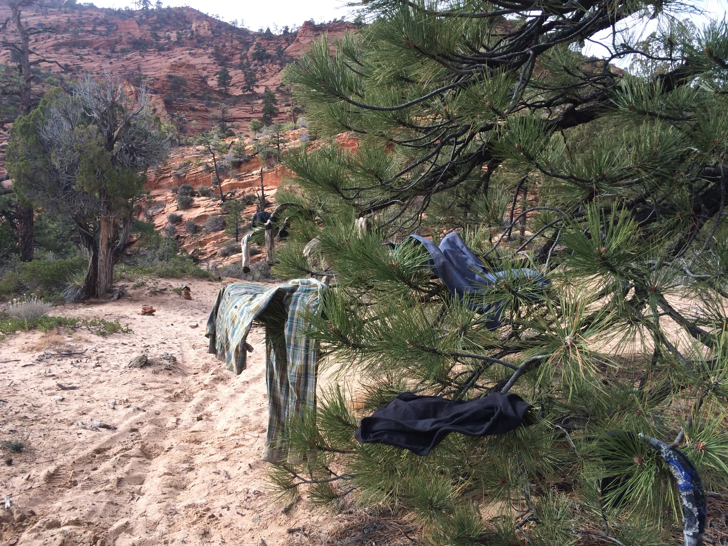
We rose in the morning in no hurry to pack up and leave. We knew that once we did we would be within just a few hours of completing our journey, and while we were excited and partly ready to be done we also wanted to be in the desert, on this trek, for as long as possible. After our second cup of coffee we couldn't find reason to delay any longer so we packed up our home for the last time, lifted our packs now light without food or much water and began our walk across the mountaintops towards the trail system of Zion National Park.

Quickly we were in view of the park road and the visitors who were experiencing the beauty of this land through the glass of their rolled up windows. We stopped for a moment, breathing the crisp air deep into our lungs, and then we continued down the rock filled gully towards the road and the tunnel that we were to take leading us to the final trail-less stretch of our journey before we  met up with a well traveled park trail. After crossing under the road we were to follow a canyon where we would intersect a trail. Quickly after entering the canyon we found ourselves at a point where we needed to hoist our packs up a steep pour off. We managed to make it up this difficult section and continued on for about an hour. When we stopped to look at our maps we were confused as to why we had yet to reach the end of the canyon where we were to find the trail. Looking closer at the map we realized we must have taken the canyon that paralleled the canyon that we should have been following. It was our last day on the Hayduke and we were still getting off route, not much of a surprise. We had to laugh at ourselves. Goose wanted to turn but I refused as our maps showed that this canyon also ended near our intended trail and I could not imagine back tracking the difficult section we had just traveled. I was sure this canyon would lead to where we needed to be, but I was unsure of what terrain we would encounter. I could not be convinced to turn around however and Goose followed along even though he did not want to continue in this direction.

Eventually the canyon began to narrow and the cliff walls began to get steeper. We scrambled up the side of a sliding scree wall to the base of a thick line of bushes. There were moments when I loosened rocks underfoot that tumbled down the steep cliff below and I held my breath knowing that one wrong move and I would be the next to tumble down. I thankfully grabbed a hold of the branches above and then pushed, pulled, tugged, scrambled and scratched my way through the bushes until we found a clearing at the top. It might not have been easier then back tracking would have been but we made it, our trail was in sight.

The rest of the walking was easy. We surprisingly had the final few miles of trail to ourselves. We were able to soak in the views as we quickly made our way over the well beaten path. Soon we stood at the top of a large set of switchbacks which led to a parking lot below. This section of trail was filled with people and cars circled the lot and roads below. We had expected a setting similar to this one, but I was still not ready for it. Within minutes we were standing on the concrete below next to a sign pointing to the Weeping Wall and the end of the Hayduke Trail. We stood around for a moment, snapped a few photos near the sign and smiled at the people who passed us as they made their way to their cars. It was an odd sensation being hurdled right back into the concrete world of road side tourists. I experienced a small feeling of accomplishment, but mainly I felt very out of place. The end of an amazing experience that was very anticlimactic. We knew this would be the case however so it was easy to push these feelings aside for a moment and focus on getting a ride into town.

One woman stopped to ask us a few questions and offered to take our photo. During our conversation we mentioned we were from Alaska and anther man who was walking by stopped when he heard this as he too was from Alaska. He was on vacation with his two young daughters and quickly offered us a ride into town. We were happy to climb into his car and be on our way.

Once in town we tried to find a friend we thought was living in Zion, but unable to find him we settled for stocking up on beer, liquor and plenty of food from the market and checking into a cheap motel room. We stayed up most of the night celebrating our journey alone together in the quiet of our room. After celebrating until the wee hours of the morning we slept late and then headed out with a plan to hitchhike 344 miles back to Arches National Park where our car was waiting. 

The hitch hike was an adventure of it's own filled with plenty of rides from interesting people, but the following night just as the sun was setting we found ourselves back in Arches National Park, our journey having come complete circle. We hopped into our car and drove into the dark of the desert where we found a quiet spot under the stars to set up our tent and return to the comfort of our tiny nylon home for one last night.

Lingering a Little Longer

We woke in the morning when the sun warmed our tent and we enjoyed coffee from our sleeping bags while contemplating our options for the day. The storm clouds in the distance seemed to have retreated and the river below appeared to have the same amount of water flow as it had the evening prior. We packed up our camp mid-morning and made our way back to the river to follow the official route into Zion National Park. We stepped into the river and quickly got used to the cold as we walked in the knee deep waters. When we reached pools of water that were deeper than I was tall we spent extra time figuring out ways to balance across fallen logs, scramble over huge boulders or make our way along narrow ledges to avoid having to swim. At one point the river narrowed into a rushing torrent through a tight channel of fallen rocks and we spent over a half an hour figuring our way through the stone and water obstacles finally giving into the fact that the waist deep wade through the pool at the base of the falls  was unavoidable. We continued our way down river until we reached a small waterfall coming from a side canyon indicating our location to climb up and out of this gorge through a route called “fat man’s misery.”  

The calm pool of water at the base of the side canyon was deep and crystal clear with shades of greens and turquoise reflecting from the deepest points. I dipped my toes into the pool to help clean off some of the sand that had filled my socks and was surprised to find the pool was much warmer than the icy river we had just exited. I happily stripped down and waded into the warmer pool to help take the chill out of my skin and rinse a layer of dirt off my body. Goose was skeptical at first, but when he saw me go deeper into the waters he joined me as well. After warming up and rinsing off we hoisted our packs back on and began to climb up a crack in the cliff wall which was filled with boulders and loose rock from decades of deterioration. As the climb got steeper, more difficult and more terrifying we began to question if we were headed in the right direction, but our maps and descriptions of the route seemed to indicate we were on track so we continued to climb.  By the top of the chute we were hauling our packs to one another and climbing up near vertical rocks that crumbled and slipped under our feet and hands. We were thrilled to finally reach the top of the canyon and were not too shocked to see a cairn at the top confirming that indeed the dangerous climb was a part of our intended route.

We were now on the top of the white cliffs in Zion walking across the rolling ridgelines through junipers and sand. We were within five miles of the National Park road and decided to make another early camp to prolong our time in the quiet wilderness that we only had to share with the lone buck that we startled near our tent site. We climbed into our beds when the sky was still light in the early dusk and we settled into our familiar, comfortable home that we had been living in for the past months. We were thrilled with our achievement in reaching Zion, but we were not quite ready to reach the very end of our journey.

Enjoying our Final Days

We climbed deeper up and into the canyons under blue skies while following clear flowing streams and a faintly marked pack trail. Our route brought us to the top of a beehive shaped mountain with expansive views of the wavelike stone formations that surrounded us. Climbing under the rays of mid-morning sun soaked us with sweat, when we reached the top and found the shade of a large juniper tree we stripped our wet clothes and decorated the branches of the tree with them while we ate a snack and marveled at the views. It was a gorgeous day and we felt at home again surrounded with nothing but views of the striped stones and amazing white cliffs of Zion in the distance. Those white cliffs marked the end of our journey and we were in no hurry to reach the end. Instead we focused on our immediate surroundings, took short side trips to explore streams and climb to view points. We picked our campsite early in the evening under the shelter of huge ponderosa pines and watched as the setting sun turned the sky shades of deep yellows, rich oranges and rosy reds and set the surrounding mountains aglow in the last light of the day.

We decided to finish our Hayduke hike with no set daily schedule or plan for how much time it would take us to reach the Weeping Rock in Zion which was less than forty miles away. We wanted to enjoy our final days, to extend our wandering in the desert for as long as possible. We also were considering several options for the final miles of our route. The guidebook described walking through the narrow canyons of the Virgin River in, “waterways that can send ripping flash floods with no warning” from storms that could be many miles from our location and we had been watching ominous gray clouds forming in the distance for days. Besides the possibility of dangerous flash floods we also were not excited at the prospect of walking for miles in the deep icy cold waters of the river which would be unavoidable. Very comfortable with our ability to create our own routes by this point in the journey we looked at our maps and our surroundings contemplating other possible options. Ultimately however, we realized we did not have maps that extended far enough to the east and if we were to head in our own direction we would have to do so for about ten miles without maps and the possibility of getting trapped at the base of the white cliffs was too risky. We instead decided to make early camp high above the Virgin River, build a fire, enjoy the evening and make a plan in the morning. After setting up camp we tramped around a bit more to explore the area and then settled next to a fire where we grilled salami on sticks and made cracker pizzas on hot stones. We savored every crispy, greasy bite of our dinner and fed the last of our twigs into the crackling coals late in the night.

Too long in town

Unwilling to walk back into the odd town of Colorado City until we knew for sure our packages were at the P.O. I called to ahead to see if our boxes had arrived. When we were told there was still not any mail for us we decided to move our camp a couple of miles further out of town and stock up with fresh food and beer to make us comfortable while we waited. We swung by the market and then walked down the highway towards a small liquor store. After grabbing some beer we sat outside the liquor store charging our phones on the side of the building. We discussed the odd lifestyle of the polygamists that inhabited the remote desert town down the road. As we pondered our many questions of such a different world several jeeps pulled up out front. We were approached by a man who asked if we would be interested in smoking a joint with them. We were unsure how to respond as this town had us really on edge, but once we broke into further conversation we realized that we were not being set up and these men were just being friendly. Soon we were circled by jeep loads of guys who were curious about us, the odd outsiders that surely everybody in town had heard of by now, and we were happy to answer their questions. We had questions of our own as these men did not seem to be like the others we had seen around. We asked where they were from and one man responded with, "born and raised polygamists in the town down the road, kicked out of the church, thank the Lord" as he tipped his hat and gave us a toothless grin. "We all live out over there now" and he pointed to a large expanse of desert on the opposite side of the hill from the town. They began to describe how we could find their place "if we needed anything, anything at all." They then invited us to "go wheeling" with them exclaiming again and again that we were "guaranteed to have a good time." We were so curious, and knew it would probably be the perfect opportunity for us to ask all of the questions that we had about the polygamist lifestyle, but reluctantly we declined. We chatted for awhile longer until they finally climbed in their jeeps and raced down the dirt road. It was a refreshing relief to have had such a nice interaction with some people in this town.

We returned to our camp tucked deep into the juniper trees and settled in for an unknown period of time. It began to rain that night and continued to rain for most of the following day. I tracked my shoes which were now on day four of what should have been overnight delivery and found that they were still not in town. Goose washed our stinky clothes in a couple of water jugs. Wearing one pair of clothes for sixteen days of hiking and no showers make for clothes that are dirty beyond description so I was super appreciative that he offered to do this for us! We listened to podcasts and lounged around in our tent which we had just received for the last days of our trip. It was amazing how much warmth was added to our December nights when we slept in an enclosed tent. We should have had the tent sent out earlier, but I was being stubborn and trying to go the entire hike with only our tarp. It was kinda silly we ended up switching out for the last fifty miles, but we were happy to have it even for the last few nights.  

The following morning I checked on my shoes again and we were thrilled to find out they were at the P.O. in town. We packed up our camp, resupplied at the market for the next days (our food boxes never made it which was okay because we were sick of the food in them anyhow) and picked up the long awaited for box at the P.O. I happily put on my new shoes and bounced on the thick soles which cushioned my feet so much nicer than my last pair with holes through the bottom. We then filled our water bottles at the gas station and began to make our way through the heart of town. Our alternate route took us through residential streets to the edge of town where we would enter a canyon and make our way back to the Hayduke Trail. As we walked through town we were passed by truckloads of children sitting on hay bails or standing in the beds. The housing compounds with matching roofs and ten foot tall solid fences or walls grew larger and larger as we reached the edge of town, some taking up entire blocks,. We were either stared at our ran away from when we saw people near the compounds. We couldn't wait to get out of there and back into the wilderness! We finally found the canyon and creek that we were to follow for the next ten miles and followed a dirt road past the last of the private lands. A truck approached from the opposite direction and we stepped aside as it slowed to pass us. As typical, this truck was also filled with young boys and the eldest at perhaps fourteen years old, who stood in the bed of the truck, exchanged greetings with us. We then looked at the driver of the truck who was a child of no more than eight years old with a toddler on his lap and four passengers who looked younger than the eight year old driver. We gawked in surprise as they drove away back towards the town and we hurried on to find a good spot far away to set our tent for the night. We were so happy to be out of that town and backpacking again!

Entering New Lands

This day we were finally going to reach our last cache where we had a plethora of much anticipated foods, plenty of water, a few buried beers, sparkling juices and a large jug of honeycrisp apple cider. We made quick time of the eleven miles and made camp in a dry sandy wash by  mid day giving us plenty of time to enjoy our cached treasures.

The following morning we hiked out of Hack Canyon and onto the Arizona strip. A large, arid expanse of sagebrush covered flat desert land that encompasses around 7800 square miles. It was such a drastic change of scenery from what seemed to be an eternity within tight, tall canyon walls and I marveled at the beauty of the open lands. We reached the strip in the early afternoon and were assaulted with whipping winds. We pushed against the gusts as we made our way through a network of dirt roads surrounded by cows, sagebrush and the occasional bird of prey. Dark, ominous clouds loomed in the distance and we pondered where we were going to set up our tarp for the night. As the sun settled into the horizon we found our route tucking its way into a small bump of land in the midst of the otherwise flat area. We found a swimming pool sized water tank fed from a spring which was protected from cattle contamination by a huge fence. We set our tarp up under a small juniper tree and filled our water bottles from the spring before settling in for dinner and bed.

We had about 15 miles of dirt roads left on the strip before we reached the hwy where we would hitch into the nearest town to pick up our boxes for our final resupply of the trail. The wind had let up over night which made the walk much more enjoyable. Somehow along the way we managed to get turned around at one of the dirt intersections and added several miles to our day before we were able to get ourselves back on track. We neared the road at about 4pm and decided to try to catch a ride before the sun went down and the post office closed. Our guidebook had given us very little information about the town of Colorado City/Hildale where we were headed other than to say that it was "a strange polygamist town with women wearing little house in the prairie dresses, curious stares from unhappy eyes, and silent children in nineteenth century garb." We knew we did not want to camp too close to this town so we decided if we had not caught a ride within the hour we would camp near the road and try again in the morning.

As I stood on the side of the road with my thumb out and a smile on face I was passed again and again by cars with passengers and drivers who looked confused, concerned or curious about my presence, but none willing to stop. After about forty-five minutes, much longer than I am used to waiting for a ride, an SUV whom I had seen staring as he drove past returned now headed in the opposite direction and swung around in the gravel when he reached our spot on the side of the road. We were greeted with the smiling face of a native american man who welcomed us into his car and chatted happily with us for the five or so miles we drove to the edge of town. He dropped us off on the main road into Colorado City and we began our walk into the town in search of the post office. 

We were a curious and a bit nervous about what we would encounter in this "strange town" and the stares from every person we passed did not help our comfort level. We walked by large compounds of houses with tall solid fences surrounding the yards. The description of the old fashioned homemade clothing worn by all of the women and children was completely accurate, and the out of date bun style hairstyles of all the women matched the clothing. At one point Goose stopped to ask a young woman in a car for directions and when he approached with an "excuse miss, can you please tell us where to find the post office" she dropped her head avoiding his gaze and stomped on the gas quick to get away from us. We could not have felt more uncomfortable or out of place looking like dirty homeless hippies in our bright clothing. I felt so uncomfortable having my legs exposed in my shorts that I stopped to pull on a pair of pants. Relived to see the post office just before closing we rushed in hoping to get our boxes and get the heck out of there. Unfortunately we were told there was no mail waiting for us at the general delivery. Dejected we asked about a place we might find dinner for the night and were told the only place in the area was the market we had passed on the highway when we came into town.

We quickly walked out of town and made our way to the market where we grabbed cold drinks and plenty of food for our first town meal in weeks. We sat outside eating and charging our electronics enduring more stares but unwilling to leave a place where we could stuff ourselves with fresh food. After eating all we could for the moment we returned to the store to restock with more goodies and carried the heavy grocery bags back to the highway in the dark. We walked until we reached what we thought to be public lands a couple of miles outside of town and we walked as deep into the juniper trees as we could to set up camp for the night. We were uncomfortable with the area and hoped our camp was far enough away.

Unfortunately we knew we had at least two more days in the area. I had worn dime sized holes entirely through the soles of both of my shoes and there was no way I could make the final fifty miles to the end of the trail. As soon as I had gotten to a place with phone service I had ordered a new pair to be sent overnight, but we knew in these remote areas we could expect it to take much longer. We crossed our fingers that the shoes, along with our resupply boxes, would arrive the following day and we could get back into the canyons and away from this creepy place.

Birthday

We slept in a while having skipped using an alarm and started the day with a “birthday mocha” and some music before packing. Not long after we began heading further up creek the water dried out and the large boulders lessened making for easier travel across the stone strewn dry riverbed. In the afternoon as we silently walked along just several yards from one another, Goose in the lead as typical, I noticed a big horn sheep that was watching Goose and Shilo from a ledge not far above where they stood. I signaled to Goose with a whistle and when the ram realized that we had all spotted him he spooked and tried to run up hill away from us. He was stuck on the ledge however and when he realized he was trapped he turned towards us and began to charge at full speed straight down the rocky cliff side. Unsure if the ram was at charging us in aggression or fear we moved towards one another in the creek bed and Goose scooped up a rock to use as defense if needed. Luckily it was not needed, when the ram hit the dry river bed he hooked a hard turn away from us and sprinted as fast as possible in the opposite direction. We laughed as our nerves settled and then savored the experience of the close encounter.

We continued on hiking; together and apart, in intense conversations and in silence. As we walked single file along one level of a multi-level stone ledge we were startled by a female sheep that had been sleeping just above us. We walked below her bed without realizing she was there and as soon as we passed she jumped to her feet and ran the opposite direction. “Happy Birthday to you!” Goose exclaimed as we took a moment to appreciate our second close wildlife experience for the day.

As the evening sun set in warm hues of oranges and reds we found a huge cottonwood tree almost glowing from its bright yellow autumn leaves. There was a tarp sized flat sandy spot below the tree, a perfect place to call home for the night.  After setting up the tarp I played ball with Shilo for a few minutes, her energy still high even after hiking all day. We then ate dinner, shared the last of the beer we had been carrying and made chocolate pudding for dessert. It was a gorgeous fall day in the desert and a very enjoyable birthday

Read More

A Thanksgiving to be Thankful For

We rose with the sun, packed our gear and climbed our way down the rock strewn shoreline. The pace was as slow as it had been the day prior but we were encouraged by the fact that we had only about a mile or so of the shoreline left until we reached Kanab Canyon where we could leave the river and head out of the Grand Canyon for our third and final time. Not long after we started boulder hopping I heard the splash of an oar in the water and a voice that called out, “would you like a ride?” I responded, “we don’t have far to go, but we would love to get off these rocks!” A yellow raft floated in view from behind the bushes and pulled up near the stone ledge where I stood. Several other rafts followed and we each happily jumped into a boat. As we settled in and exchanged introductions we were handed oranges, breakfast burritos and beers. I immediately devoured the eggs, bacon and potatoes wrapped in a tortilla and washed it down with a cold PBR while constantly thanking the group and exclaiming how amazing it all tasted.

All too soon our side canyon appeared and the rafts pulled up to a beach to drop us off. As we jumped back onto the sand they began tossing us more beer and asking what else they could give us. We could not believe the timing of this amazing trail magic as our almost empty food bags were quickly refilled with a feast. We couldn't say “no” to anything they offered and when we finally waved goodbye as they floated down the river we were left with a pile of goodies on the beach at our feet. We giggled and danced around as we gathered the cans, fruits and packaged treasures. We moved to a warm spot in the sand and decided how to start on our thanksgiving breakfast. We heated sausages and canned potatoes in our stove while snacking on string cheese. I slurped sweet juice off of my fingers as I peeled oranges and savored each segment with my eyes closed and a smile on my face. When our bellies were full and our heads a bit light from the beer we gathered up the remaining gifts and began our hike away from the river.

Our spirits and energy levels were high as we walked in the cold water of Kanab creek most of the afternoon. We marveled at the beauty of this large side canyon and although our feet were wet, we were happy for the constant water source and the vibrant life that flourished in the wet environment. Our guide book had warned that this canyon was prone to flash floods that could be triggered from storms miles and miles from where we hiked. Although the skies were clear we knew better than to make our camp in the canyon floor. As the sun dipped below the horizon we climbed a shrub choked ledge to try and find a safe and suitable spot for the night. The ledge was covered with rocks and boulders of all sizes that fell from the towering cliff walls above and sharp cactus filled any spot that was not mounded with stone. We searched the length of the ledge until our headlamps were required to see and could not find an even semi flat spot that would be safe from the crumbling rock overhead. With no other options we climbed back down the ledge to the canyon floor below and continued our way up the creek. After a few more twists in the canyon we found another high ledge to search. This spot was perfect with many flat areas to choose from and we happily set up our tarp. After feasting on more of the gifted goodies from our now stuffed food bags we settled in for the night and closed our eyes.

Time and time again U have been provided with exactly what was needed most while hiking, and this day was no exception. That is how trail magic works.

The Real Thunder Canyon

We woke to our alarm the following morning and we were hiking with our headlamps when the sky turned shades of grays with the first light of the day. We were determined to get ourselves back on route and cover some good miles. We were now on day seven since our last food resupply, a resupply in which we carried out a “heavy seven days” worth of food. Luckily our estimated “heavy seven” was actually a good solid eight days of food which we could stretch further if needed. It was definitely going to be needed as we still had over fifty miles to go, almost all of which was difficult terrain without a trail to follow where our pace would creep to less than one mile an hour at times. For the start of our day however we did have a trail and we made quick time as we found our way down the canyon to the intersection with the real Thunder Canyon which we had thought we had been in all day the day prior. We easily followed the trail as it climbed up and out of the side canyon, across Surprise Valley above and back down Deer Canyon to the Colorado River again.

We stopped for a break at Deer Springs where an immense rocket of water shot out from a sheer stone cliff high above the ground and free fell to a crystal pool below. We filled our bottles, took a short break and continued towards the river. The cliffs began to narrow and Deer Creek began to drop below us carving and winding deeper and deeper into the rock. We had to squeeze around a couple of tight corners and tiptoe around narrow ledges until the canyon spat us out on a cliff side that was bright in the afternoon sun. We soaked up the view of the green waters of the Colorado river below us and the colorful walls of the Grand Canyon that were carved in both directions and then we began to make our way down the crumbling hillside to the beach at the bottom.

We reached the sand and followed the waters of the river down the canyon. This was the beginning of a seven mile stretch that would follow the Colorado River picking our route through spots of sand and thorny bushes eventually leading to what our guidebook called, “The most tedious four mile boulder hop that you will ever experience in your life.” Not just the most tedious on this hike, but in our entire lives. We couldn’t wait to get these four miles over with.

Goose’s long legs gave him a huge advantage as he hopped from rock to rock. I would watch him leap over cracks and gaps in one seemingly effortless bound while I would have to lower myself down or around taking eight to ten steps for each of his jumps. He quickly covered ground and would periodically wait for me to catch up giving me a good natured hard time for taking so long. We sat for a snack and noticed four huge big horn sheep across the river from us. We enjoyed our food while they grazed on greenery not far from us and reluctantly we continued down river as they watched us from their beach on the other side.

The evening sky began to change and knowing that we had only a short time until the canyon grew dark we decided to find a flat spot on a high sandy perch for the night rather than attempt the challenging boulder course by headlamp. We set up our tarp and bed and then began an inventory of our food, determining how much we could allot for the night and how many calories we would have to get us through the next two days, which just so happened to be Thanksgiving day followed by my birthday. Caloric wise we would be fine as we still had a 2000 calorie bag of nuts, about a dozen bars, a few protein drinks and a handful of other snacks, but it would not be the thanksgiving and birthday celebrations that we had been planning for as those special meals were waiting in cache buckets about forty miles away. It was hard not to be disappointed as I thought about the hungry hard miles we had ahead of us on what we had planned on being fun celebratory days on trail, but I tried not to dwell on it as we closed our eyes for the night and prepared for another early morning and more boulder hopping down river.

The wrong canyon

We thought that we had gone through all of the ice cold pools of water that the canyon had hidden between its narrow stone walls, but within the first mile of the morning we found another set of unavoidable chutes that led to chilly black water. We decided to keep our clothes dry so we stripped before we slid down the stone and submerged ourselves into the pool. I was able to walk on tiptoes to avoid swimming, but the chest high water was so cold that uncontrollable gasps took over my normal breathing. We pulled ourselves out of the water, quickly tossed on our packs and practically ran down the canyon to try and get our blood pumping. Around the corner we found a sliver of sunlight that arced down the side of the canyon to the floor below and we stopped to put our clothes back on. We moved on down the canyon ready for our upcoming intersection with a side canyon that would mark our intersection with an actual trail that we would follow for a short stretch.

Thunder canyon was the side canyon that would lead us along a river, past a cave, past a spring and up to a valley which would be our passage down to the Colorado River. When we arrived at a well beaten path at a side canyon marked with multiple cairns we hooked right and followed the path and the cairns up the canyon along the river. Eventually the cairns and path indicated that we needed to cross the river. This was not how it showed on our maps so we backtracked to ensure we hadn't missed a turn. When we found ourselves back at the start of the trail we figured we must have been on the right track and returned to the creek crossing and got our feet wet to reach the other side. The path continued, marked with cairns, up the canyon climbing and dropping up and down the steep rock cliff side. We stopped many times to double check our maps as the route didn't quite seem right, but each time we seemed to make our maps fit the well marked path we were on. When we reached a cave at the end of the canyon, followed by a spring, we were convinced we were on the right path. But the path seemed to end and the stone canyon walls towering above, impassable. We searched and searched but could not seem to find an exit to the valley we were looking for. We checked and rechecked our maps. We climbed to the highest point at the end of the canyon to get a better view. We split up to scour every unseen area in hopes of finding the trail, but it was nowhere to be found. Dejected we backtracked again and just before dark reached the initial intersection with the side canyon. We were confused, frustrated, annoyed, baffled and bummed. We stomped down a flat spot in the midst of a weed and bush covered area under a tree, the only flat area to be found in between a huge field of boulders, and crawled into bed.

We lay in silence for awhile, struggling with our individual emotions and thoughts about being stumped on how to continue. I finally pulled out our map again, determined to figure out why we could not find our way out of Thunder canyon. At first I concentrated solely on the details of Thunder canyon and then I expanded my vision to the entire map and back tracked our steps to the camp spot from the previous night, a disappointingly short distance from where we now lay. Then I retraced the contour lines on the map until  I reached the first side canyon. It was at that time I realized the first side canyon, the canyon we were currently camped in, the canyon we had been searching all day, was not Thunder Canyon. Surprisingly there were two side canyons, only a quarter mile from each other, both of which had a rushing creek fed from a spring just next to a cave. We were in the wrong canyon. UGHHHHHH!!!!!!!

Bushwhacking back into the Grand Canyon

The following morning I woke to the sound of cracking tree branches and smiled knowing that Goose was getting a fire going which would make crawling out of my warm, cozy bag into the shimmering, frozen world much easier. We sat by the fire with cups of strong coffee while we began the long tedious process of melting the 18 liters of water that we needed for our next two day waterless stretch. The melting process took the entire morning which allowed us some time to make a few gear repairs, play our flutes (I got Goose a small wooden flute to accompany the flute he had given me) and dry out our tarp and sleeping bags from the moisture of the previous night. After lunch we packed up, ensured the fire was extinguished and hit the trail trying to make up for the morning hiking hours we had lost.

We followed a network of dirt roads that wound through the tall trees of the north canyon plateau. The winds howled and sang as the slender trunks of the pines danced to the songs, bending and creaking an accompanying tune. We startled a herd of wild bison and watched as they thundered through the thick forest. Although we saws signs of humans while following the dirt roads we did not see any people out on this cold day as winter made it's permanent presence known. Our route took us even further from the possibility of seeing people as the following day we cut off the trail and into the thick bushes of a choked side canyon which would be the start of our third decent into the Grand Canyon. This time we would be bush whacking, creek walking, boulder hopping and route finding our way to the Colorado River, along it's banks and then back up a twenty four mile side canyon where we would find the last food and water cache that we had waiting for us.

We began this off trail route with a thick bush whack through sticker covered branches. Once we reached the larger side canyon the terrain opened up a bit allowing for a quicker, painless  pace over the river rock and dry sandy creek beds. The towering sheer cliff walls shaded us for most of the day and as the walls began to narrow into a winding labyrinth of slick stone we found ourselves climbing around deep cold pools of water trying to avoid getting wet. Eventually it was unavoidable. We searched all possible alternatives but the only way to continue down the canyon was to sit on the slick rock and slide into the dark pool below. We splashed into the icy water and struggled to keep from sliding on the slick rock under our feet as we waded and through a series of thigh and waist deep puddles. When we finally made our way into a wider part of the canyon I was shivering in my wet clothing and we rushed to get our blood flowing as we searched for a flat spot to put our tarp before the evening sky grew completely dark. We climbed into our warm wool base layers and down sleeping bags just as headlamps became necessary. The terrain had beat us up all day long and we had only covered about twelve miles. We ate dinner while strategizing and psyching ourselves up for an easier day to come with big miles to push and went to bed ready for what the following day had in store.

Out, in and out again at the Grand Canyon

We climbed out of the Grand Canyon, the first of three times that we would do so on the route, and hitched into the popular South Rim. We spent the day there eating, shopping for our resupply, showering, eating, securing permits for the next stretch, drinking, eating, doing laundry, visiting and eating. We grabbed a final snack at 1pm and returned to the trail hiking the steep switchbacks that dropped to the bottom of the canyon in a hurry to make the sixteen miles we needed to hike, hopefully before dark. 

For this next stretch of approx. 120 miles we carried about 7-8 days worth of food. We had a few long waterless stretches which meant as we climbed back up to the North Rim the following day we lugged weight on our backs that far exceed the comfortable carrying capacity of our lightweight backpacks. When we reached the top of the canyon rim by late afternoon we discussed our options for water. We had a cache in the woods about 28 miles away and about a liter left for each of us. The ranger station was about four miles in the opposite direction with guaranteed water, but our maps showed three possible springs en route to our cache. Recent snows on the North Rim boosted our confidence about the possible spring water so we pushed on down the dirt road towards the first spring where we planned to camp for the night. As the sun dipped behind the trees and lit the sky on fire with reds and oranges we drew close to our planned stopping point just as a car approached from the opposite direction. The couple stopped to talk and ask us the typical, "where did you come from and where are you going" questions. Surprisingly while talking they mentioned having been looking for the springs when driving around and that from what they could tell all were dry. We didn't worry too much about this comment as often things are overlooked at the speed of a car, but just in case I dropped a few hints about having been counting on this water source and soon was able to yogi a gallon of water from the kind couple. The newly acquired water allowed us to stop for camp just as the sky was darkening so we settled in ready to hike to our cache the following day.

The hike the next day was easy walking on dirt roads the entire time. We quickly found that the couple from the night prior was correct in their assessment that the springs were dry and by late morning we were out of the water that they had given us. After hiking a few more miles we found some large patches of snow where we stopped to melt enough to get water for the remainder of the day. With the long snow melting break and the early setting of the winter sun we soon found ourselves walking in the dark by early evening, and at over 8,500ft elevation the temperatures quickly plummeted well below freezing. We donned all of the clothing that we carried, I wrapped a bandana around my frozen nose and we continued on the final miles to reach our water. 

When we reached the spot where we had stashed our cache we were more than ready to hop into our down sleeping bags and grub on some hot food. We grabbed the 2.5 gallon jugs we had hidden and quickly realized that the six gallons of water we had left for ourselves were now six gallons of solid ice. We lugged the heavy blocks into the trees, set up our tarp and began chipping away at the ice with our pocket knives in order to get enough water for our dinner. It had been another long day. The walking might have been on easy to follow dirt roads, but the additional challenges of the cold and the work required to get water made it easy to fall into a deep, exhausted sleep as soon as I was finished eating.


Best hitch EVER!

The winds howled in the night and rain sporadically fell in large drops, but we were well protected under our tarp which we had tucked into the mouth of a cave. When we rose to pack up camp it was cold but the skies had cleared and the winds had calmed. The river water had also dropped, resembling more of the typical flow of the Colorado and revealing large slabs of stone that allowed us to walk further down this side of the canyon. We followed the newly exposed route about another mile down river until we were stopped again at a "hitching beach". We settled into the cold sand, layered in all of our clothes looking upriver for any approaching rafts, happy that at least our waiting area would have different scenery today than the day prior.

About an hour into our wait Shilo dog began to get excited about something approaching. We thought at first it was our long awaited raft ride but realized quickly it was Jen and Dan hiking up the shore. We happily greeted each other, warned them that it might be a long wait and settled back into the sand together as they pulled out all of their clothing layers to stay warm. Our warnings about the long wait to come however were unnecessary, not long after we were startled to see one yellow raft floating towards us. We jumped up in excitement and I ran to the rivers edge to flag the boat down. 

The raft pulled ashore and two guys hopped out to say hello to the smiling hikers, still a bit confused as to where we came from and where we were headed. They were happy to ferry us across the river so we all hopped in their boat just as the rest of their rafting party approached, four more boats filled with smiling, confused people who welcomed us to their party.

Together we floated across and slightly down river to the confluence of the Little Colorado River where all of the boats pulled ashore and we were able to meet the rest of the party and answer a few of their questions about our mysterious appearance. As we talked we were handed fresh fruit, beer and bloody marys. The crew explained that they were taking a short hike up the side canyon and if we would like to join them we could then raft the rest of the afternoon in their boats. I was quick to jump at the offer and together we hiked a short distance up the Little Colorado impressed by the unique white and turquoise colors of the river.

After our side trip we parted ways with Jen and Dan who decided to continue the route on foot and piled onto the front of one of the rafts. We floated through a combination of calm waters and white rapids throughout the day and after our first soaking from the icy whitecaps I wished that I was wearing a dry suit like all of the other rafters. When we stopped on a shady beach for lunch I quickly stripped off my wet clothes and jumped into my sleeping bag to warm up. Goose heated a hot water bottle to warm me further and my shivering soon stopped. We shared in the pasta lunch with the group and returned to the water for another stretch of splashing rapids. It was an amazing experience, but I was ready for the warmth of dry land when they dropped us at a beach just before sundown. 

Rafting down the Colorado River in the Grand Canyon is by far the coolest hitch I have ever gotten and this was the easiest twenty mile day I had ever had on trail...we were happy hikers!

Waiting for a raft ride

The following two days we followed the Colorado River filled high with waters released from the recent annual flooding. Our route no longer followed much of a trail, other than the occasional game trail. We rock hopped, boulder scrambled and kicked in steps on the crumbling slopes as we balanced above the rushing waters below.

We visited the ruins of ancient granaries built high up on the cliff side. It was a place Goose had been looking forward to seeing for a long time and the stone structures and views from the rocks high above the river did not disappoint.

After a stretch of down river travel we reached a point where we needed to cross the Colorado River via a hitch from a passing by rafting group.  It was a part of the Hayduke that I had been really excited about and I half joked that perhaps we could hitch with a raft further than just across the river. Goose was doubtful reading aloud from our guidebook, "Rafts can only take passengers who are listed on the permits so don't even think about asking for a ride further down." We had only seen two rafting groups in the past two days so we settled into our beach enjoying some forced down time. 

When long distance hiking there is usually a daily pressure to make the miles. A small sense of nagging guilt when you sleep late, stop early, take detours or play around when you should be hiking. I try to avoid this guilty feeling with a typical hiking attitude that it is about the journey, not the destination, but I still get antsy when sitting too long. 

However, a forced break when you can't be hiking even if you want to is an amazing feeling. We reveled in this feeling all afternoon, but as the sun dipped behind the tall canyon walls and  we set up camp for the night we realized we might be enjoying a much longer beach break than we anticipated.


Into the Grand Canyon

We camped on the edge of the Grand Canyon National Park border and in the morning had a four mile walk down a dirt road to reach the trailhead which would lead us down Nankoweap Canyon to the Colorado River. We had arrived to our camp spot after dark the night prior and in the morning we became fully engrossed in some conversation as we began walking out of the field and onto the road. It wasn't until over an hour later that we decided to check our maps assuming we were very close to our trailhead and realized that we had been walking in the wrong direction all morning. We still amaze ourselves at our ability to make these stupid simple mistakes, but we laughed at our far too familiar blunder and turned around because there was nothing else we could do.

When we finally reached our trailhead (a 10-12 mile hike that should have been 4) we found a familiar tent set up surrounded by the telltale signs of a retrieved cache of five gallon buckets and we knew it must be Dan and Jen. Shilo confirmed this with her excited prancing around and we spotted them on a bluff with amazing views of the canyon below. We stopped by for a short visit and then had to push on down the trail as we intended to reach the creek at the bottom of Nankoweap which showed as 7.8 miles away on our maps. 

We had read a warning in one of our papers that our maps were 10-25% off on mileage accuracy throughout the entire Grand Canyon when compared to other canyon maps, but we didn't imagine that this would truly be the case for all mileage. We followed an amazing trail that skirted the edge of towering cliffs and pushed our comfort in a few steep areas until the sun set in dazzling colors and we took out our headlamps in the darkness of night. Finally the contouring trail began a decent into the canyon as we finished the last of our water. We continued down in the dark, my pace slowing as the night grew on and the last miles became a painful march to the creek. When we finally arrived we filled our water bottles, set up our tarp and happily crawled into bed. 

We later found that the trail was about three miles longer than our maps indicated. We should have known at that moment our supposed 150 miles in the Grand Canyon were going to be long miles.  

Jacob's Lake & Arizona

The Arizona Trail took us immediately to the Kaibab plateau at elevations over 8,000ft. The day following our joining of the Arizona Trail we arrived to a much anticipated resupply stop in Jacob's Lake. The one lodge/store/restaurant at this stop had been holding our packages for us, but the packages were not what we were excited about, we were excited for town food. Our hiker hunger had fully kicked in at this point and our trail food was getting hard to swallow. We hiked in from our camp on the outskirts of town in time for breakfast and while we waited for our hot food to arrive I purchased a bag of fresh baked cookies and pastries from the bakery for us to enjoy as a breakfast appetizer. Once our bellies were full we picked up our boxes and set up at a nearby picnic table to explode our packs and reorganize for the next stretch. We also used this time to digest our breakfast so we could return for lunch in a few hours. Not only did we order lunch, but we also ordered grilled cheese sandwiches and blue cheese burgers to take on the trail with us for dinner and breakfast the following morning. 

We hiked out of Jacob's Lake that evening and found a flat spot to set up camp just before dark. Before jumping into our setting up of camp "chores" Goose suggested that we sit for the sunset and enjoy a beer that we had carried out from town. While we were sitting he pulled out a long slender wrapped package that had been rolled in his sit pad and handed it to me. I opened the unexpected gift and found a gorgeous hand carved Native American wooden flute. We both excitedly played with the flute creating a mixture of beautiful tones and high pitched squawks as we figured out how to create music with our new trail toy. We played until after dark and finally set up camp once it was too cold to remain outside of our sleeping bags any longer.

The following morning the skies were blue but the strong winds were icy and there was no denying that fall was shifting into winter. Tall slender pine trees filled the landscape at these elevations and they sang to us with loud creaks and groans as they bent and and danced in the powerful gusts of air. Occasionally we would hear the far off crack of a hunters gun at the end of deer season and we would play our flute during our breaks in hopes of scaring the wildlife away from the hunting grounds. We continued to revel in the easy hiking trail and tree filled vistas as we made our way across the plateau to the Grand Canyon.

Mindless hiking

We had twenty four miles until we reached the Arizona border and during those miles we found ourselves following fresh deer tracks down the beautiful length of Buckskin Gulch and then winding our way through the narrow path of the longest slot canyon in the U.S. When we emerged, grinning and giddy from the maze like walk in the tall, shaded stone walls we found ourselves at an intersection of canyons. When we stopped to check our maps we found a petroglyph drawing of a deer on the black stone slab canyon wall. We were excited to share our finding with two other hikers who were passing by and they took us around the corner from where we were sitting to show us an entire panel of stone carvings. 

After a long period of lingering with the ancient art we continued hiking and found ourselves in another narrow, twisting slot canyon which spat us out at a trailhead not far from the Utah/Arizona border. We reached the border just when headlamps became necessary to see our surroundings and we found a campground with covered shelters, picnic tables, privies and several other campers. We thought we would make dinner in the campground and then hike another five or so miles to our next water source, but when we arrived at the campground we found the two hikers we had met earlier and found ourselves visiting for awhile over chips and beer which they kindly gave us. Since it was getting later and we were in such a nice place we decided to set our bed on the concrete floor beneath a shelter and stay there for the night.

The following morning we crossed into Arizona and began to follow the Arizona Trail which would take us most of our next section to the rim of the Grand Canyon. It was such a treat to have a marked trail to follow! We were able to stretch our legs and our stride, to get lost in our thoughts and deep into our conversations without having to worry about paying attention to our maps and landmarks in order to find our route. This was the type of long distance hiking that we had known before on other trails and as much as we both love the Hayduke and the challenges that it provides we were thrilled to have a bit of "mindless hiking" on a trail for awhile.

More hiker trash

In the town of Kanab we were dropped off at the small outfitters/coffee shop/book store and not only were we able to get the additional gear that we needed, but we also ran into several other hiker trash. An AT hiker, Carry On, worked at the gear store and when we walked into the store she was helping two 2010 PCT hikers, Chocolate Bandito ad Happy Feet, whom I had met while doing trail magic at Sonora Pass the year that they hiked. Apparently our Hayduke hiker friends, Jen and Dan, had just left about thirty minutes ago. We knew by the good company that we were in the right place to re-gear and hang in this little Utah border town.

After a huge lunch, post office run and gear purchases we decided to get a campsite on the edge of town where we could also get showers and use the campground internet. We scrubbed ourselves as well as all of our dirty clothes in the showers until the shower water finally ran clear and then we stayed up late under our tarp enjoying the comforts of town. The following morning we packed up, ate one more town meal for lunch, picked up a few items fro the gas station and stuck our thumb out on the side of the road. The first car to exit the gas station pulled over and the driver Carter offered to give us a lift ten of the thirty miles we needed to go. As we got to chatting with Carter on the ride he soon offered to take us the entire distance and later pulled over on a dirt road near where we thought we needed to be to get back on trail. As we packed to leave we had to decline an offer to stay at Carter's home for the night but we continued to chat and found ourselves quickly engrossed in deep, meaningful conversation ending in hugs and knowledge that we would probably be talking again someday. He gifted me with his straw hat before he left and after he began to drive away he threw his car in reverse, leaned out the window and tossed something to me. I snagged it from the air initially thinking we had forgotten something and then realizing it was a necklace that Carter had made. 

I put on the necklace and hat and we began to walk down the side of the road towards where we thought we had left our water jugs the day prior. The open desert terrain all looked the same from the highway and we thought we had gotten off close to our hitching location the previous day, but as we walked we began to realize we might be further from that spot than we thought. We continued to walk down the side of the road and when the sun dipped behind the cliffs we stopped to put our sunglasses away. It was at that time a state trooper turned around to question what we were doing. We explained where we were headed and while he may have thought our explanation was a bit out there he left us to our road walk. Five miles later we finally reached the location we had intended on when hitching out of town. Since it was after dark we found a flat spot on the hillside just a bit back from the road and set up for the night. We might not have made much trail progress for the day, but we had some great experiences and we had at least made it out of town and back to the trailhead.